The middle portion of
the Nueces Canyon centers around the towns of Barksdale (at the jct of
TX highway 55 and Ranch Road 335) and Camp Wood (at the jct of TX hwy 55
and RR 337). Edwards County is to the west and Real County is to
the east, with the Uvalde County line running across the south end of
the photo.
Just to the north of Camp Wood is the confluence of the Nueces River and
Camp Wood Creek, which extends to the east, roughly paralleled by RR
337, and Pulliam Creek which extends to the northwest, more or less
followed by TX 55. Interestingly, the Edwards/Real County line
follows Pulliam Creek for a short distance before reverting back to the
Nueces River at Barksdale. This was |
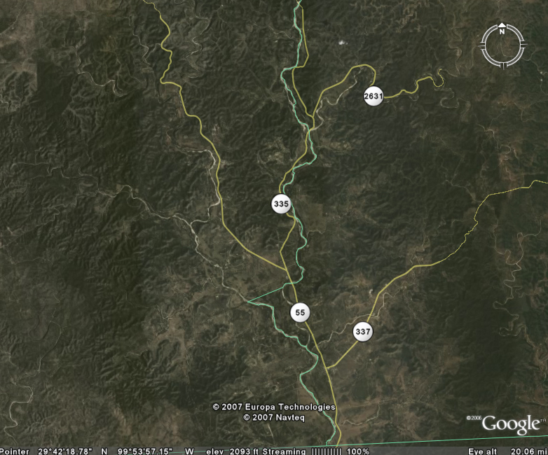 |
| apparently the result
of confusion on the part of the original surveyors, as the county line
was originally intended to be the Nueces River - however, at their
confluence, Pulliam Creek and the Nueces River have similar water
levels, so the confusion is understandable.
In the middle portion of the Nueces
Canyon, the canyons widen significantly as the rivers flow to the south,
with wide plains dotted with oaks and mesquite in the vicinity of Camp
Wood and Barksdale. |